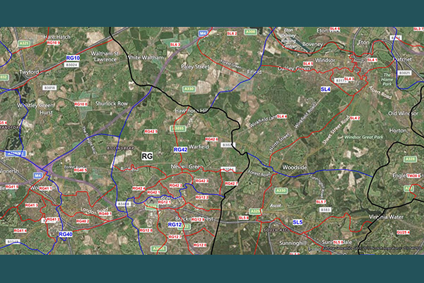
PostMap
PostMap contains boundaries of more than 9,000 postcode sectors, 2,700 postcode districts, and 120 postcode areas in Great Britain, as well as over 200 sectors and 80 districts in Northern Ireland.

Details
PostMap provides the following files:
- United Kingdom postcode areas
- United Kingdom postcode districts
- United Kingdom postcode sectors
- Northern Ireland postcode area
- Northern Ireland postcode districts
- Northern Ireland postcode sectors
Features
- Available in high or low resolution
- High resolution boundaries provide greater detail
- Low resolution version displays more quickly and uses less disk space
- Displays postcode data for the entire UK using the British National Grid coordinate system
- Provides separate data for Northern Ireland using the Irish Transverse Mercator Grid
- Contains workspaces that display boundaries and labels at optimum zoom levels
ooioioiiiooioioiioiiooioiiiooiooiiioioioiiiooioioii
Specifications
Coverage
United Kingdom
Release schedule
Bi-annually
Unit of sale
Country