FSA and 6-Digit Postal Codes
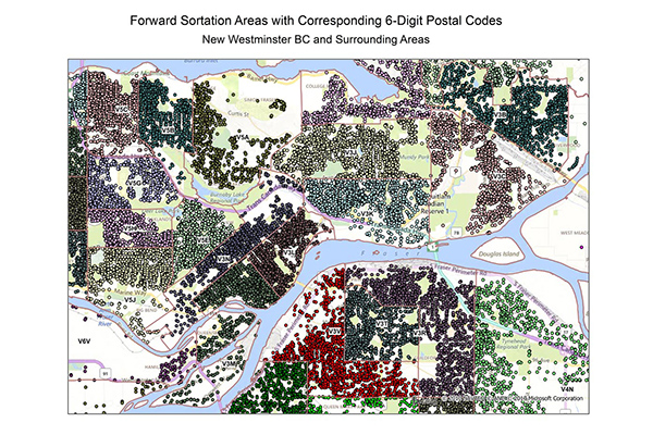
FSA and 6-Digit Postal Codes are available separately or in a bundle. The FSA file contains the polygon boundary files and centroids for Canada’s Forward Sortation Areas (FSAs). The 6-Digit Postal Codes file contains over 800,000 postal records and over 4,000 new postal codes. Latitude and longitude coordinates and a single “most representative point” are provided for each postal code in Canada.
Visualize on a map
Benefits
- Simplify mapping and demographic analysis of customer records
- Link postal geography with Dissemination Area (DA) boundaries
- Assign DAs to the most appropriate FSA
- Create boundary files by snapping FSA boundaries to DAs where no alternative descriptions are available
- Limit overlapping boundaries by determining which direction a postal code and/or street segment split should take across DAs
Details
- 6-Digit Postal Code points extracted from Canadian postal points
- Includes 3-Digit FSA boundaries with postal and province codes
Features
- Includes more than 1,600 urban and rural FSAs across Canada
- Assigns most FSAs to one or more Dissemination Area centroids
- Gives the latitude and longitude of the single “most representative point” for every Canadian postal code
- Provides a total of over 800,000 postal records
ooioioiiiooioioiioiiooioiiiooiooiiioioioiiiooioioii
Specifications
Coverage
Canada
Release schedule
Bi-annually
Unit of sale
Country, Province
