Understanding Wildfire Risk: Smarter Data for Better Coverage and Risk Management
In my experience working with insurers, accurately assessing wildfire risk has long been a challenge – and today, that challenge is more pressing than ever. Research shows that the risk of extreme wildfires has doubled in the past 20 years alone, which makes increasing the accuracy of risk assessments a top priority.
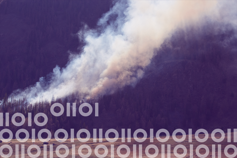
Wildfires were once thought of as more of a seasonal threat confined to forests and undeveloped areas, but unfortunately, this perception no longer holds up. When extreme weather conditions – like long-term drought and strong, dry, sustained winds – align, the risk of urban conflagration (home-to-home ignition) rises exponentially.
Fire behavior is becoming increasingly unpredictable due to a combination of climate trends, environmental conditions, and land development patterns. This, in turn, places mounting pressure on insurance companies to assess risk with pinpoint accuracy so they can properly quote and bind policies and best serve their customers.
Accurate, granular insights are needed to make these goals a reality, and that’s where advanced wildfire risk assessment solutions come into the picture.

The Evolution of Wildfire Risk Models
If you’re an insurer, you know that understanding wildfire risk is crucial not just for your organization’s bottom line, but for ensuring that homeowners have access to fair and sustainable coverage.
And yet, achieving this has historically been much easier said than done. The problem? Traditional wildfire risk models struggle to deliver what’s needed, as they do not incorporate fire behavior modeling. Instead, they often take a broad approach that makes it difficult to assess individual property risk accurately. As a result, homeowners in areas that appear high-risk at a regional level may face challenges in finding affordable coverage, even if their specific property is a lower risk.
By leveraging advanced wildfire risk datasets, you’re able to differentiate risk with greater accuracy, ensuring that coverage is priced fairly and offered to more homeowners who qualify for it. This level of precision helps you strengthen your risk management strategies, while also giving policyholders more confidence in their coverage options.
What sets modern solutions apart?
Research shows that the frequency and severity of fires has increased dramatically in the last couple of decades, and traditional risk models fall short in predicting this increased risk. Recent disasters, like the California fires at the start of this year and the 2023 fire in Lahaina, Hawaii, are tragic demonstrations of this trend. They showcased the real-world impact of urban conflagration – displaying how fires can spread rapidly in urban settings, igniting structures in ways that older models didn’t take into account.
This alarming trend has driven the demand for wildfire risk assessment solutions that go deeper into the details that matter most. While traditional models focus primarily on vegetation, distance to a fire station, and historical fire perimeters, modern approaches integrate multiple advanced variables that are often overlooked:
- Fire behavior modeling: Unlike additive scoring systems, true fire behavior modeling – using gold standard software such as FlamMap and Behave – considers fuel, weather, topography, and other variables to dynamically predict how a fire will behave, at 30m resolution. Outputs from this foundational modeling include: rate of spread, fireline intensity, flame length, and other critical variables in determining risk.
- Ember modeling: Some of the most destructive wildfires don’t just spread through direct flames – they’re fueled by wind-driven embers that can ignite homes far from the flaming front of the fire. Advanced models incorporate ember dynamics, a subset of fire behavior modeling, to better assess risk.
- High-precision geocoding: Accurate location data ensures that risk is assessed at the property level, so insurers can make more informed decisions – rather than relying on sweeping, regional risk assumptions.
- Urban conflagration analysis: In extreme wildfire conditions, flames and embers can spread between buildings – even in areas with little vegetation. Modeling these urban fire dynamics is now critical to accurately assess risk in cities and suburbs.
Data Products
Wildfire Risk Data Products
Wildfire Risk is a cutting-edge database that helps assess wildfire hazards and risks. It considers various factors like terrain, climate, and human activities, such as the slope of the land, type of vegetation, frequency of past fires, proximity to water, wind patterns, non-burnable surfaces, and the distance to fire stations.
How to Improve Your Wildfire Risk Approach
I recommend a few best practices that will enhance your approach to wildfire risk assessment. Here’s how you can ensure the best outcomes for your customers and business alike:
1. Seek models that incorporate fire behavior science.
Many risk models rely on outdated methodologies that treat risk as a static checklist rather than the dynamic equation that it is.
That’s why the best solutions are those designed by wildfire scientists and experts with real-world fire science and fire suppression expertise. They bring a unique knowledge and approach to fire science and an understanding of the distinct challenges related to urban conflagration.
2. Consider both baseline and extreme scenarios.
Standard risk assessments often focus on typical fire conditions, but as an insurer, you need insights into how properties fare under extreme weather events – when fires are most likely to become catastrophic.
To get those insights, look for models that account for factors like temperature, humidity, maximum wind speeds, wind direction, and fuel moisture to predict extreme fire events with the potential for urban conflagration.
3. Leverage granular, property-level data.
Not all properties within a high-risk zone face the same level of exposure, but some risk models categorize entire regions the same way. You need data that differentiates risk at the structure level so that policyholders can access fairer pricing and lower-risk properties aren’t grouped into high-risk categories due to overly simple approaches.
4. Educate policyholders on mitigation strategies.
Risk assessment should also empower your policyholders with knowledge. Using advanced wildfire models to identify risk factors, you can then recommend mitigation efforts to help homeowners reduce their exposure. For example:
- creating defensible space around a home
- using fire-resistant construction materials when remodeling
- understanding the role of ember-resistant ventilation openings in home hardening
Case Study: Using Advanced Risk Models to Expand Coverage
Precisely is working with an insurance client that seeks to grow by offering coverage to more policyholders in California – a state where rising wildfire risk has made securing coverage increasingly difficult.
To help the company gain a more accurate picture of risk, we analyzed over 1 million high-value properties in the state that closely matched their current policyholder base. We then analyzed each property using our baseline Wildfire Risk model and Wildfire Risk Extreme model to assess changes in risk under more severe fire conditions. This uncovered key insights:
- Approximately 40% of properties showed increased risk, representing over $935 billion in property value
- Approximately 60% of properties showed no change in risk, totaling over $1.5 trillion in property value
- Of all these properties, just over 60% (totaling nearly $1.5 trillion in property value) were identified as low-risk opportunities for growth.
These insights enable the insurer to expand their coverage and grow strategically. And crucially, they mean that many homeowners who might have been previously overlooked due to less rigorous risk models now have a better chance at securing coverage.
Wildfire Risk Map & Assessment Database – Physical & Climatic Modeling
Wildfire Risk is a scientific and up-to-date wildfire risk assessment database & map with modeling for physical, climatic & man-made variables.
Better Coverage and Confidence
Property owners benefit from more accurate insights, particularly granular wildfire risk analytics, and this has major implications for the insurance landscape at large.
When more insurers leverage these insights, homeowners gain access to:
- competitive pricing
- expanded options
- the ability to shop for policies that best suit their needs and budgets
At the same time, insurers can better educate homeowners on the specific risks facing their properties, and offer insights into mitigation – for example, retrofitting with building materials that harden the structure or understanding the difference between flammable and Firewise vegetation.
Ultimately, these insights give insurers the ability to operate more sustainably, balancing growth with smarter risk management.
The Future of Wildfire Risk Assessment
The risk of wildfires is growing, but so are the tools available to assess and manage it more effectively.
As an insurer, you can embrace advanced, science-backed wildfire risk modeling to make better decisions in your risk aggregation, pricing, and underwriting strategies while providing more homeowners in the communities you serve with access to the insurance they need, when they need it most.
Want to enhance your wildfire risk assessment? Learn more about Wildfire Risk data products.


Data Appending vs. Data Enrichment: How to Maximize Data Quality and Insights
A former colleague recently asked me to explain my role at Precisely. After my (admittedly lengthy) explanation of what I do as the EVP and GM of our Enrich business, she summarized it in a very...

Connected Data, Better Insights: Data Enrichment Done Right
I’ve been reading a lot about the “rapid pace of change” – as if change itself is a new thing. The reality is that business has always been defined by rapid change, and change, by definition,...

5 Reasons to Use APIs to Unleash Your Data
“Data is a key ingredient in deeper insights, more informed decisions, and clearer execution. Advanced firms establish practices to ensure data quality, build data fabrics, and apply insights where...